UAV LiDAR and photogrammetry data processing

What is LP360 Drone?
This is the core product for drone geospatial data workflow. Maximize your LiDAR and imagery data with visualization, QA/QC, classification, 3D editing, and analysis capabilities. It includes the features below.
- Intuitive workflow
- Multi-flight import and processing
- GIS interface allowing combination with other geospatial data
- Powerful point cloud visualization with multiple and synchronized windows: 2D, 3D, profile and immersive synchronized windows.
LP360 Drone Features List
Intuitive sensor processing workflow
- Import data and perform quality check
- Manage coordinate systems – datum and projection
- Split LiDAR data in strips
- Enhance strip matching with Strip Align and Adjustment (additional module required)
- Integrated photogrammetry workflow (additional module required)
License Features
- Desktop application with floating license (one device)
- Project size limited to 10km2
LiDAR and imagery 3D explorer tool
- Synchronized three windows viewer (2D, 3D, profile) for advanced visualization
- View 3D Gaussian Splats for immersive visualization
- LiDAR quality control and repair tools
- Extensive filtering capabilities by any combination of class, elevation range, intensity etc.
- Advanced 3D feature edit tools
- Image Explorer allows the selection of images containing any point selected on the point cloud for contextual inspection
- Desktop patrolling capabilities for systematic review of features in a 3D environment
Powerful product creation tools
- Smoothing tools
- Ground classification tools (automated)
- Breakline digitalization tool and enforcement
- Digital elevation model/digital terrain model tool
- Volume calculation, automatic base (toe extraction)
- Volume Ribbon with streamlined volumetric tools, including automatic base creation and toe extraction
- Classify by GIS data layers and features (including 3D points, lines, and polygons)
- Convert 2D vectors to 3D by automated surface elevation and extraction
For DJI L1, L2 & L3 Users
-
with LP360 Drone:
- Import your processed data from the DJI Zenmuse L1, L2, L3 after Terra processing
- Easily adjust and correct the LAS format, with the ability to split LAS files into manageable strips
- Clean and prepare data efficiently for the Strip Align Add-On
-
With DJI L1/L2 Cloud Batch Processing Add-On:
- Import your raw project data directly from the DJI L1 or L2 (No DJI Terra processing needed)
- Seamlessly process PPK, GNSS/INS trajectory data directly from raw files
- Streamline your workflow by processing everything within LP360, saving time and enhancing accuracy
Maximize your workflow with add-on products
Process, analyze, and maximize drone survey data, producing valuable information and deliverables
Supported LiDAR Sensors
Seamless Data Processing Across Varied LiDAR Sources. LP360 is a powerful software suite designed to efficiently process data from any system including UAVs, airborne, and mobile platforms. Once the data is in standard LAS format or LAS + trajectory you can use an extensive geospatial toolbox to generate impressive deliverables. Supported Sensors include:
Features Highlights
NEW: PRODUCT ADD-ONS
Enhanced AI Classification (AI Ground+, AI Forestry, AI Utilities)
Building on the success of Automatic AI Ground Classification, LP360 expands its AI-powered classification with new, pre-trained deep learning models that simplify point cloud processing. There’s no training data to collect, no machine learning expertise required, and no parameters to dial in. Just select the AI tool, click a button, and get consistent classification results, faster and with less manual work.
- AI Ground+ Classification expands beyond ground-only classification with above-ground feature segmentation for richer deliverables—ground, vegetation, building roofs, roof objects, walls, fences, vehicles, bridge decks, and water surfaces.
- AI Forestry Classification automates tree segmentation and produces forestry-ready outputs, including canopy, trunks, fallen trees, per-tree vectors, crown polygons, and canopy height model (CHM) rasters.
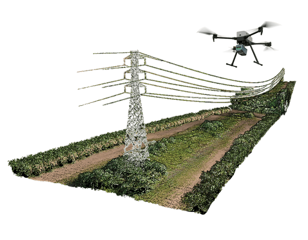
- AI Utilities Classification is purpose-built for transmission corridors, extracting wires and structures to accelerate utility analysis—wires, towers/poles, insulators, guy/jumper/guard wires, attachment points, plus vegetation.
From surveying and AEC to forestry and utilities, these add-ons streamline classification and feature extraction into a guided, “click-and-go” workflow so you can spend less time classifying and more time delivering.
LP360 Strip Align
Data can exhibit small geometric inconsistence, especially when combining data from multiple flights. Strip Align for LP360 Drone detects and corrects these errors via an application of sensor-specific mathematical modeling. Strip Align is a fully automated process with no need for users to set project-specific “tuning” parameters or to move in and out of the LP360 Drone processing environment – press a button and it works!

LP360 Cloud Collaborate
Take collaboration to the next level with LP360 Cloud Collaborate.
Easily integrate cloud storage, streaming, and advanced search capabilities to optimize your workflow and enhance collaboration among team members, partners, and clients.
- Flexible Cloud Storage: Securely store all your LP360 data in one centralized location. Starting at 200GB, your storage can expand as your project needs grow, ensuring easy access through both LP360 cloud and desktop software.
- Real-Time Data Streaming: Work efficiently on large projects by streaming and sharing only the data you need in real time. You can browse, stream, and share datasets directly from the cloud without downloading full files.
- Automatic Ground Classifications: Benefit from two automatic ground classifications per month to streamline your data processing tasks.
- Power Up with PowerSearch: Easily find your data with PowerSearch. Outline a map section or search your geospatial files by metadata such as location, date, and classification, to instantly find all files containing geolocated points within that area.
- Enhanced Security: Trust in state-of-the-art security protocols and AWS-backed encryption to keep your data safe, securely hosted in Ohio.
Supported LiDAR sensors
Seamless Data Processing Across Varied LiDAR Sources
LP360 is a powerful software suite designed to efficiently process data from any system including UAVs, airborne, and mobile platforms. Once the data is in standard LAS format or LAS + trajectory you can use an extensive geospatial toolbox to generate impressive deliverables. Support Sensors include:
- CHCNAV
- DJI
- LiDAR USA
- Microdrones
- Phoenix LiDAR
- Resepi
- Riegl
- Rock Robotic
- TrueView
- Wingtra
- YellowScan
Sensor Processing Module
Seamless Data Processing Across Varied LiDAR Sources
LP360 is a powerful software suite designed to efficiently process data from any system including UAVs, airborne, and mobile platforms. Once the data is in standard LAS format you can use an extensive geospatial toolbox to generate impressive deliverables. Support Sensors include:
- TrueView
- Microdrones
- DJI
- Riegl
NEW: IMPROVED GRAPHICAL USER INTERFACE
Enjoy a more user-friendly experience!
The new LP360 Graphical User Interface (GUI) makes it easier and more streamlined to complete your data processing and generate high-quality deliverables in an intuitive GIS environment. We have introduced Ribbons, and most importantly the ability to create your own custom ribbon and toolbar to match your specific workflow.
It’s now easier to find the tools in the organized ribbon tabs:
- Project tab: Everything you need at one place to manage your project
- Sensor tab: Merges the toolbars TV workflow and Utilities to ease the user workflow from Cycle import to creating a pointcloud and orthomapping.
- Map tab + Map toolbar: All map feature are now handy on top of the main map and use less features in the tab.
- Cloud tab: Easily access LP360 Cloud
- Support tab: Get help easily from the Geocode Customer Support team
- Custom tab: Create your own custom ribbon and toolbar to match your specific workflow
- Quick access toolbar: Add your favorite feature for a quick access
Drone LiDAR and photo processing workflow made simple
- Intuitive workflow
- Multi-flight import and processing
- GIS interface allowing combination with other geospatial data
- Powerful point cloud visualization with multiple and synchronized windows
Get the most out of your L1 & L2 Data with LP360 Drone
DJI L1 and L2 are supported sensors and can be processed with LP360 Drone:
- Manage your coordinate system (geoid, grid to ground, local site, datum and epoch change)
- Leverage LP360 powerful 3 synchronized viewing windows and Image Explorer tool
- QC/QA your data with Automatic Ground Control Detection and 3D Correction
- Access all the other advanced tools of LP360 Drone such as Smoothing, Automated Outlier Removal, Automatic Classification, Break lines, DTM and Contour Generations, export to CAD formats, volumetric calculations, powerlines encroachment tools and much more
- Customize / define your own workflow with the new GUI
- Go further with unique LP360 Cloud extension (optional add-on) to store, search, share and stream your data with any LP360 Desktop
Improve your data quality
- Strip align your data for geometric correction (optional add-on)
- Smooth your data to increase precision
Manage your coordinate systems
- Extensive list of coordinate systems available
- Allow datum transformation including epoch change
- Allow reprojection
- Local site calibration
- Grid to ground
LPLAS File Format: Improve the viewing experience to see all the details that you need
Intelligently manage the level of detail displayed in your project. Smart technology ensures that you always have the best view of your geospatial subject possible, within LP360. Best of all, LPLAS is still backwards compatible and can be opened up in any application that opens LAS files.
When an LPLAS file is opened in LP360, you enjoy the added functionality of this optimized viewing. In addition, you can open your library of LAS files in LP360, convert them to LPLAS, and breathe new life into your old datasets with enhanced viewing!
IMPORTANT NOTE: An LPLAS file is a LAS file: Extension is *.LAS It is compatible with any software that will read an LAS file. It follows the ASPRS standard for the most up to date specification for LAS file.

Leverage your photos with Drone Image Explorer tool
- Explore your data
- Find conjugate images
- Make true measurement on your photos
Simplify workflows into CAD software
- Generate and validate breaklines, enhancing surface for CAD applications
- Reduce dataset for CAD applications
- Export data into CAD software with various CAD formats available
Process your data collected with TrueView and Microdrones sensors
For TrueView and Microdrones sensors, LP360 Drone takes raw flight data and generates colorized, georeferenced 3D LiDAR point clouds. Geotag the imagery collected to create highly accurate orthomosaics. Process without the need to employ other software applications, reducing workflow complexity and time. Requires sensor module license.
3D Accuracy: automated horizontal and vertical checks and corrections of the point cloud
Automated horizontal and vertical checks remove the need for manual interaction
- Automatically transform your check point coordinates into you project coordinates including datum and epoch
- “AutoTarget” – Automatically find a 3D target on a drone dataset
- Calculation of correction for any 3D target
- Seamless workflow to apply the correction on the point cloud
- Use with Accuracy Star ground control equipment, as well as checkboards or concentric targets.
LP360 Photo Add-On
- Ultra-fast ortho mapping from a point cloud
- Create your orthophoto backdrop in a completely integrated workflow
- Efficient fast processing
- Export photo package to your 3rd party Photogrammetry software
- Support most common 3rd party sensors (DJI Mavic 3E, DJI Phantom 4 RTK and DJI Zenmuse P1)
NEW: LANDXML Export
More options to export your data
Requested by many users, we now offer export to LANDXML data file format, containing civil engineering and survey measurement data commonly used in the Land Development and Transportation Industries, so you can continue your work in a CAD environment.
NEW: LP360 Version 2024.1
What’s New in LP360?
The latest version of LP360 2024.1 includes the following updates:
- TV540 Support
- Wingtra Support/New Post Process Tool
- Support for DJI L2
- DJI PPK Utility
- Trajectory Processing via Job Manager
- Single Cycle View Mode
- Auto Checkout of Licenses as Needed
- Surface Precision (SDASN)
- Tree Segmentation (ITS) (EXP)
- LP360 Cloud Processing
- LP360 Cloud Raster Support
- LP360 Cloud Raster Streaming
- Export Wizard Batch Processing via Job
- Manager
- Translation/Rotation of Rasters